
search
Purple line metro map
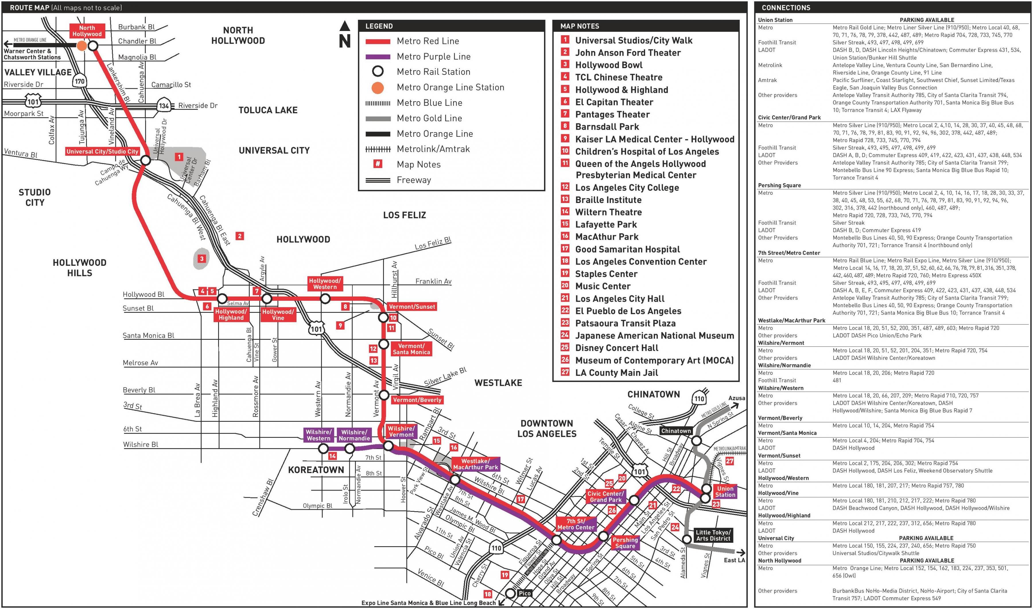
LA metro purple line map. Purple line metro map (California - USA) to print. Purple line metro map (California - USA) to download. Since 2007, the former Metro Red Line Wilshire branch has been designated as the purple line metro. The purple line metro now shares tracks with the Metro Red Line between Union Station map and Wilshire/Vermont (6.2 km), before serving two stations exclusively. The entire purple line metro is underground.
One of Metro priority projects, the purple line metro extension is a critically important rail project that will provide a high-capacity, high-speed and, dependable alternative for commuters to travel between downtown Los Angeles map, the Miracle Mile, Beverly Hills and Westwood. From the current terminus at Wilshire/Western, the purple line metro extension will extend westward for about nine miles and add seven new stations providing easy access to the Westside, our region second-largest job center. Travel time between downtown Los Angeles and Westwood with purple line metro is expected to be about 25 minutes.
The purple line metro is a subway line that currently consists of eight stations, beginning at Union Station in Downtown Los Angeles map and terminating at the Wilshire/Western Station in Koreatown. The purple line metro extension will extend the line west, adding seven new stations through Miracle Mile, Beverly Hills, Century City, Westwood, and West Los Angeles. With trains running every 10 minutes, the completed Purple Line Extension will be the fastest and easiest way to get to UCLA from downtown Los Angeles. Similar to the Exposition Line, the purple line metro will become a critical east-west connection in the city.