search
Los Angeles interstate map
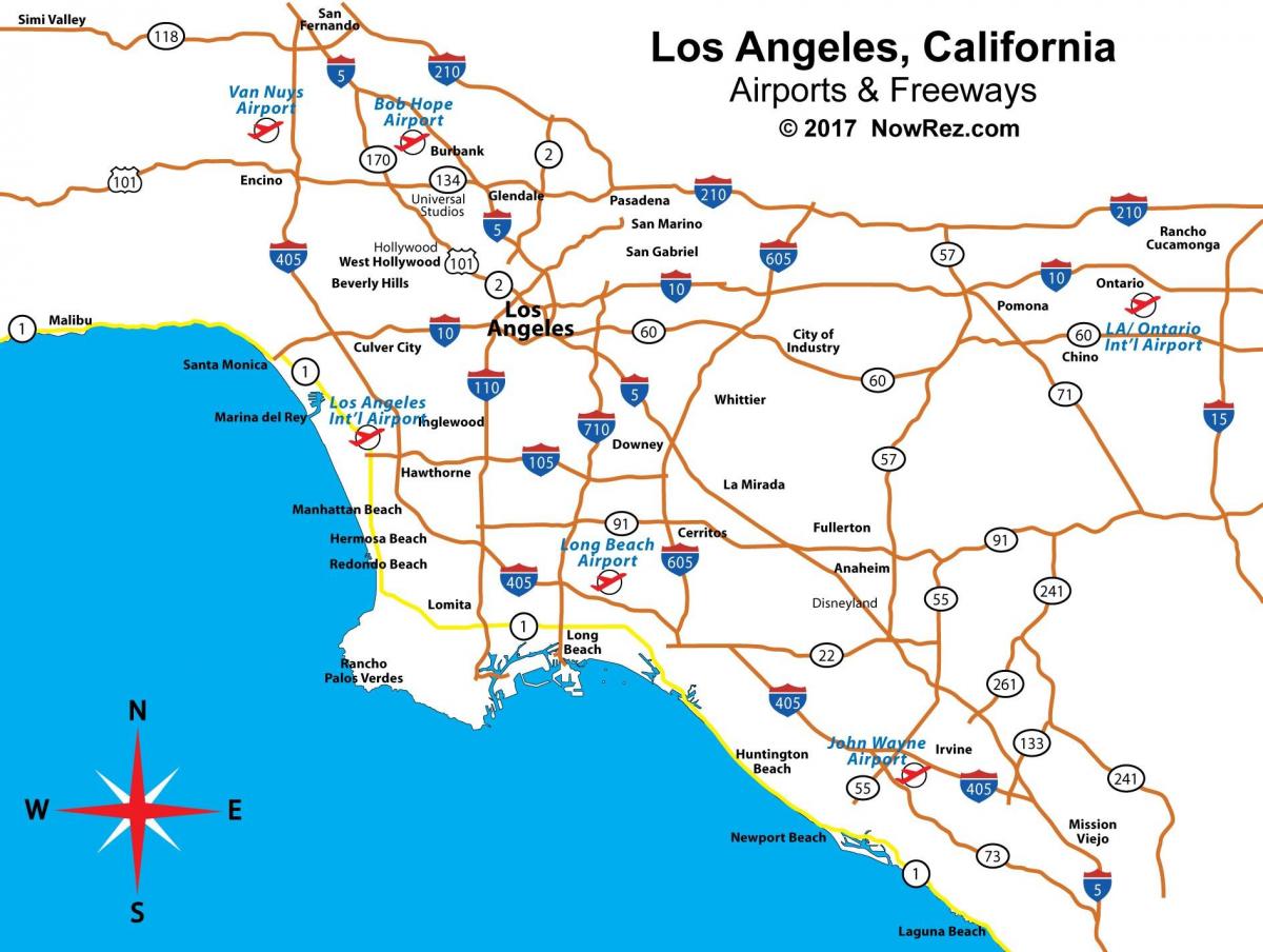
Map of Los Angeles interstate. Los Angeles interstate map (California - USA) to print. Los Angeles interstate map (California - USA) to download. Interstate 405 aka the San Diego Freeway is the main north/south freeway for the Westside in Los Angeles interstate map and roughly follows the outline of the Pacific coast for much of its route. The 405 is one of the busiest freeways in Los Angeles interstate, the most commonly used highway to LAX, and a bypass for Interstate 5. The 405 northern terminus is the 5 in the San Fernando Valley. It runs south from the Valley, travels through the Westside and continues south from LAX towards Long Beach, then turns east and merges with the 5 again in Orange County in Los Angeles.
Interstate 10 aka the Santa Monica Freeway/San Bernardino Freeway is the main east/west freeway connecting Downtown Los Angeles and Santa Monica. Formally named the "Christopher Columbus Transcontinental Highway" in Santa Monica, Interstate 10 travels east from Los Angeles interstate map all the way through Phoenix, Houston and New Orleans to Jacksonville, Florida. The Santa Monica Freeway is the westernmost segment of Interstate 10, beginning at the western terminus of I-10 at the Pacific Coast Highway in Santa Monica and ending southeast of Downtown L.A. at the East Los Angeles Interchange, which connects the I-10, I-5, SR 60 and US 101 freeways.


