
search
Los Angeles highway map
Los Angeles highways map. Los Angeles highway map (California - USA) to print. Los Angeles highway map (California - USA) to download. Los Angeles is served by an extensive network of freeways, streets, and local and regional public transportation systems (as its shown in the map of Los Angeles highway). A dozen major highway that span hundreds of miles connect the various regions of Los Angeles When locals give directions, they usually refer to a freeway only by its number and the word “the,” e.g. "Take the 405 to the 10" instead of “Take the San Diego Freeway to the Santa Monica Freeway.”
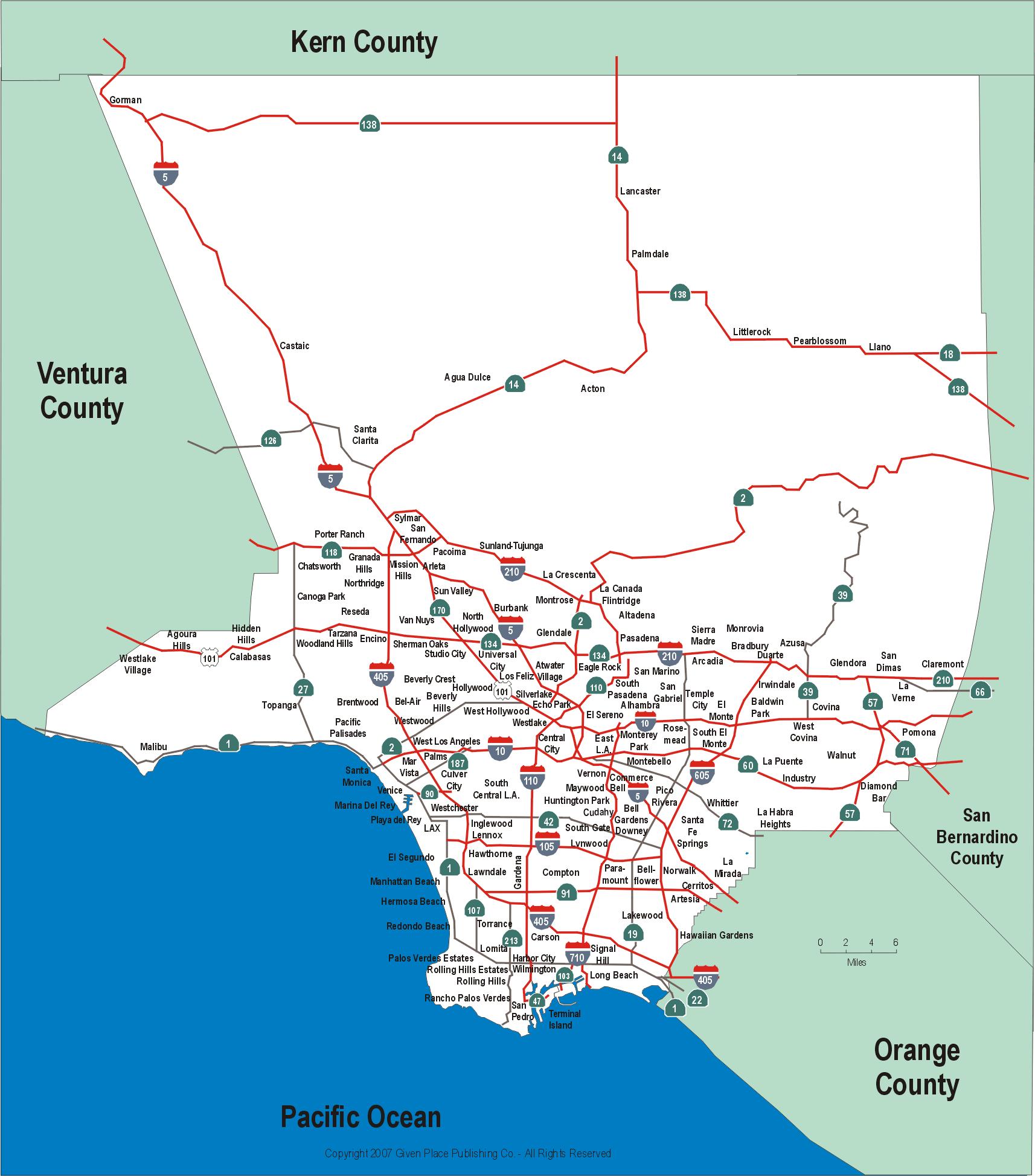
Interstate 405 aka the San Diego Freeway is the main north/south in Los Angeles highway map for the Westside of Los Angeles and roughly follows the outline of the Pacific coast for much of its route. The 405 is one of the busiest Los Angeles highway, the most commonly used highway to LAX, and a bypass for Interstate 5. The 405’s northern terminus is the 5 in the San Fernando Valley. It runs south from the Valley, travels through the Westside and continues south from LAX towards Long Beach, then turns east and merges with the 5 again in Orange County.