
search
Los Angeles bus map
Los Angeles bus routes map. Los Angeles bus map (California - USA) to print. Los Angeles bus map (California - USA) to download. In Los Angeles, buses go everywhere in Los Angeles bus map and are cheap but they are slow because they rarely take freeways, and most of them stop at midnight. The Los Angeles bus system is quite complex (not to mention the pricing) because there are several networks. Beware, the almost 200 bus lines are managed under the name METRO (or MTA), which also manages the metro network (see below). Los Angeles bus network is complemented by other local networks, such as the Big Blue Bus in Santa Monica (which reaches LAX International Airport, Culver City and Westwood, as well as Wilshire Western Station and Downtown by fast bus (lines number 7 and 10).
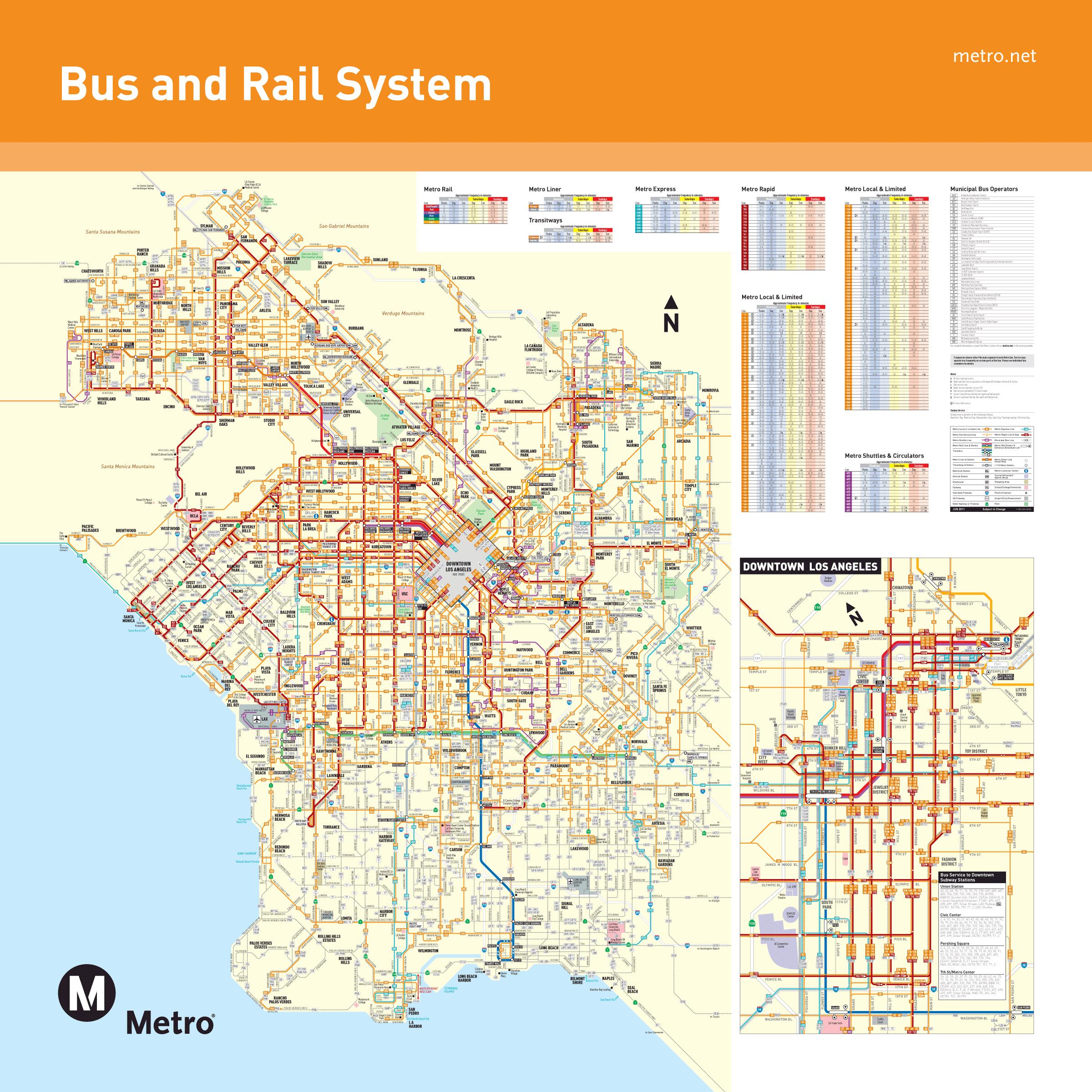
Los Angeles offers a good city bus network of about 200 routes in Los Angeles bus map divided into three categories: Los Angeles Metro Local (orange) buses serve the main arteries of the city with numerous stops. Metro Rapid buses (red) run along the Los Angeles busiest streets with fewer stops than the local service. The journey is also faster since these buses get priority over traffic through a system of radio transponders. The Metro Express buses (blue) follow the city motorway network and provide fast service to residential suburbs.
In Los Angeles, two companies manage bus services. They cover both the city centre of Los Angeles bus map and the inner suburbs: Metro Bus and DASH. The City of Los Angeles Transportation, known as LADOT, offers an even more comprehensive bus service (DASH), which runs through the center and the main neighborhoods around Los Angeles. The service has 5 lines that run through downtown and 27 other lines that run through areas such as Hollywood, Vermont, Koreatown, or Chinatown, among others.