
search
LA train map
Los Angeles train map. LA train map (California - USA) to print. LA train map (California - USA) to download. In LA train map the Union Station is a beautiful station in a rather indefinable style, like Art Deco rustic version, located in front of the Pueblo de LA. It is there that you take your ticket for the Amtrak Coast Starlight, the train that connects LA to Seattle via San Francisco and its magnificent landscapes along the Pacific Ocean. From here also leaves the Metrolink to Anaheim, Santa Ana or Ocean Side (connection to San Diego). In front of the station, all possible connections: bus, subway, shuttle to LAX (LA airport).
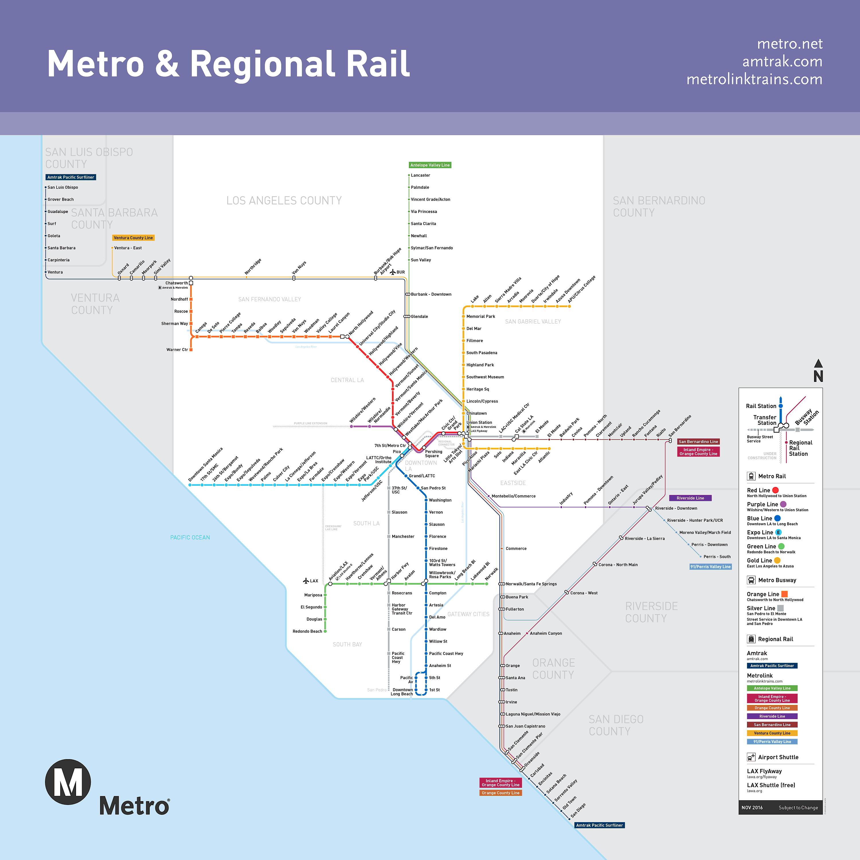
LA metro trains and buses in the same direction within two-and-a-half hour windows are now included in the base fare as long as you use LA TAP and tap the final transfer within that window. LA TAP connects most of the LA train map and bus lines, city-specific buses, and shuttle options including LADOT, Santa Monica Big Blue Bus, LAX buses, Santa Clarita Transit, Long Beach Transit, and even the historic Angels Flight funicular.
The LA train system is currently comprised of four above-ground light rails and two underground subways in LA train map, but it is constantly growing. In 2016, the Expo Line Santa Monica extension and the Gold Line Azusa extension were completed. The LA Purple Line is currently under construction to add 9 new miles of track to eventually go from downtown to Westwood.