search
LA rail map
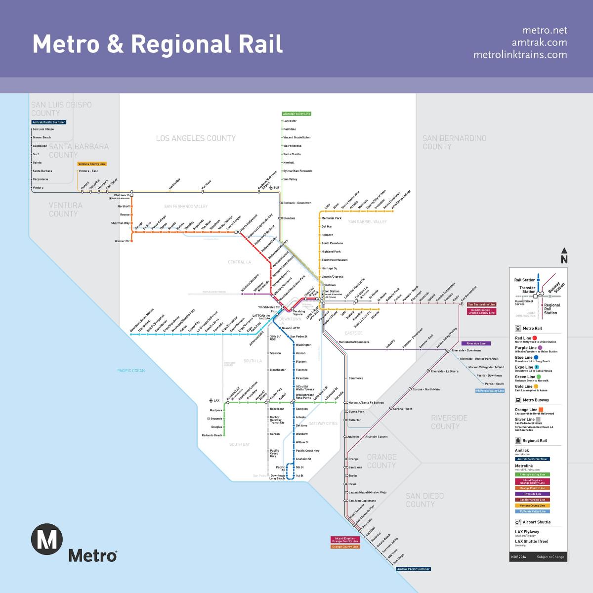
Los Angeles rail map. LA rail map (California - USA) to print. LA rail map (California - USA) to download. The Metro Expo Line (commuter train) of LA rail map provides services that connect Westside with Downtown LA, Hollywood, South Bay and Long Beach. The LA rail Expo Line introduces 10 new stations, including USC, Expo Park and Culver City. The Metro Gold Line (commuter train) runs between Pasadena and East LA, connecting the Red and Purple lines to Union Station.
The Metro Blue Line (commuter train) of LA rail map runs north to south between Long Beach and Downtown LA, where it crosses the Red and Purple lines. The Metro Green Line (commuter train) runs east to west between Norwalk and Redondo Beach, crossing the Blue Line. On Metro Rail Los Angeles and Metro Orange Line, fares, passes and LA Metro registered credit must be loaded onto a Metro LA TAP card.
Back in the 1920s, LA rail was connected by Pacific Electric Railway Company aka Red Cars. It was the largest electric railway system in the world. But LA rail was dismantled as auto ownership became the dream and massive freeway systems were built. It wasn’t until 1990 that the subway, the blue line, returned to Southern California map. And despite the common misconception that no one uses it, LA rail the third-largest public transit system in the country by ridership.


