
search
LA metro green line map
Metro green line map Los Angeles. LA metro green line map (California - USA) to print. LA metro green line map (California - USA) to download. In 1995, the metro green line of LA map was inaugurated as an east-west line along the median strip of I-105 (Century Freeway) from Norwalk to Aviation, while the western section of the LA metro green line to Redondo Beach continues on an elevated structure. The LA metro green line intersects with the Metro Blue Line at the Imperial/Wilmington station.
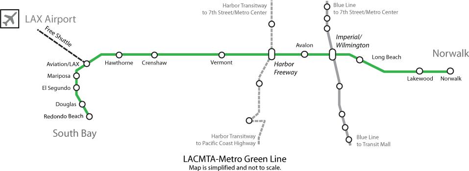
The metro green line of LA map is totally segregated from other traffic, so although it uses the same rolling stock as the Metro Blue and Gold Lines, the LA metro green line can be classified as a full metro line. Normally P2000 Siemens 2-unit trains are used on this line. The distance between Long Beach Blvd and Lakewood stations is 6.8 km. A trip with LA metro green line from end to end takes about 32 minutes. A branch from the Aviation Station (where free shuttle service to LAX passenger terminals is available) into the airport itself may be built in the future.