
search
LA metro bus map
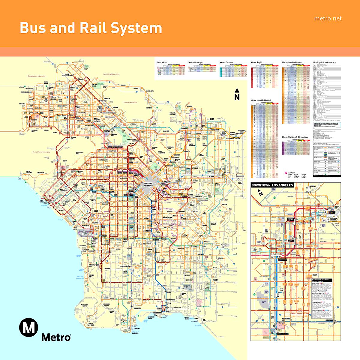
Los Angeles metro bus map. LA metro bus map (California - USA) to print. LA metro bus map (California - USA) to download. Local, Rapid, Express and BRT (Bus Rapid Transit) services are available throughout the Greater Los Angeles area. With nearly 200 different routes, buses as its shown in LA metro bus map travel from all over the region to all major destinations such as national parks, major attractions and shopping areas. Many LA metro bus routes connect to LA Metro Rail stations. The metro bus local (orange in color) has many stops along the main streets of the city.
Six fast metro buses of LA run through Downtown map, with departures every 5 to 10 minutes between 6:30 a.m. and 6:00 p.m. on weekdays, and every 15 minutes between 10:00 a.m. and 5:00 p.m. on Saturdays and Sundays. LADOT offers a reliable and stress-free of LA metro bus service to Downtown LA in the morning and then in the afternoon to the beach districts and the San Fernando Valley.
In LA metro bus map the Red Buses or the Metro Rapid buses take less time to reach the destination, but they service less bus stops, meaning you might have to walk farther to reach your intended LA destination. Otherwise, Orange Buses or Metro Local buses of LA metro bus take longer to reach the destination, but they service more bus stops, allowing you to get closer to your intended destination.