search
Crenshaw metro line map
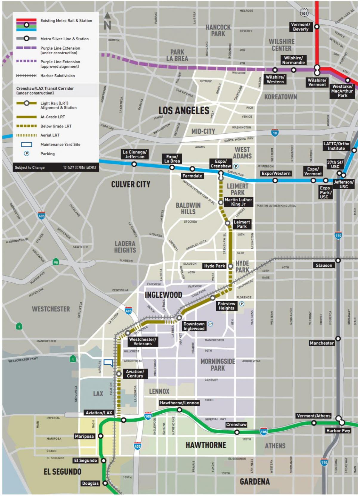
Map of crenshaw metro line. Crenshaw metro line map (California - USA) to print. Crenshaw metro line map (California - USA) to download. The crenshaw metro line/LAX Line will extend from the existing Metro Exposition Line at Crenshaw and Exposition Boulevards map. The Line will travel 8.5 miles to the Metro Green Line and will serve the cities of Los Angeles, Inglewood and El Segundo; and portions of unincorporated Los Angeles County. The new Metro Rail extension of crenshaw metro line will offer an alternative transportation option to congested roadways and provide significant environmental benefits, economic development and employment opportunities throughout Los Angeles County.
The Crenshaw metro line/LAX Transit Project will serve the Crenshaw District map, Inglewood, Westchester and surrounding area with eight stations.The Crenshaw metro line/LAX Project is one of 12 transit projects funded by Measure R, the half-cent sales tax approved by Los Angeles County voters in 2008. The project began construction in 2014 and anticipates completion in 2021.


