
search
LA river map
Los Angeles river map. LA river map (California - USA) to print. LA river map (California - USA) to download. Three waterways cross the LA river map: the westward-flowing Santa Clara River in the north; the LA River in the south, extending from the San Fernando Valley east and south to the Pacific Ocean; and the San Gabriel River of LA, which rises from the San Gabriel Mountains in the north and flows south to the ocean.
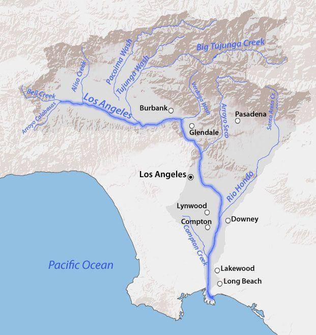
The LA river is on the verge of a new era. In the few years since the flood control channel was reclassified as a “navigable waterway,” the region has re-embraced its oddball amalgam of concrete and nature, which winds roughly 51 miles from the San Fernando Valley out to the ocean in Long Beach map. The last time the LA river was reborn it was the late 1930s, and it had been drowning the young city periodically since its birth. At some points, the river was just a trickle; in other parts, it was uncontrollably wild, and flooded frequently and devastatingly.
The LA river, formed by a large watershed that drains the Santa Susana Mountains, the San Fernando Valley, and the San Gabriel Mountains, played an important part in the geological formation of the LA basin. Areas adjacent to the LA river map comprised riparian ecosystems with a myriad of native plant and animal species. The river periodic floods provided rich sedimentary deposits across the floodplains.